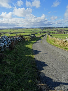
Today was supposed to be my last day of walking for this trip. I had 17 miles left to go to get to Letterkenny. It was to be my least anticipated walk - taking place entirely on N-roads (the same as UK A-roads or US highways) and the weather was due to be heavy rain for the entire day. I had already decided that I would send my backpack ahead to my final hotel via taxi as I set off. It would be tough going and I knew I would feel vulnerable on the road but I was game. It was the last walk. However much a challenge it had to be done.
When sleep overtook me last night it dragged me into a feverish dreamworld. I tossed an turned a lot and finally woke up at 5am drenched in sweat. My throat was sore and I thought I was coming down with a cold. I was bothered by the fact that I was bothered. Let's face it I've had far worse walks on this trip - howling gales, hailstones, sleet and mountain passes - a little bit of rain and big roads didn't bother me. But something wasn't quite right.
When I was getting ready for the trip I tried to check in for the outgoing flight and the return flight but they would only allow me to check in for the outgoing flight saying that the return flight was too far away. I was anxious then because I would have no facility to print out my boarding pass. Luckily there's now an app so that you can check in and get an electronic boarding pass on your phone. I was covered, but at the back of my mind I was irritated that I couldn't check in. I'd checked in that far ahead of a trip before. I hate it when airlines change the rules.
I'd tried several times this last week to check in. I'd been keeping an eye on my emails waiting for the check-in notification. It still hadn't come. So when I woke up too early this morning and could not go back to sleep again, I thought I'd try again. Again it said no. It was too early. With only one day left before coming home it was most certainly not too early. I tried again. No dice. Then I got a notification: Your check-in will open in 10 hours. That would be less than 24 hours before the flight. That had to be wrong. I looked at the info again for the hundredth time and then I saw the piece of information that I'd been blind to for the whole week - the date of the return flight was Sunday, 20th MARCH. Not February - March. I wasn't booked on a flight home tomorrow at all. I was booked on one a month from now.
You know that feeling when you come to a realisation that throws all your plans into instant chaos? It feels as though you've been pushed in the solar plexus. Hard. The air leaves your lungs and your next gasp in comes with a flood of panic, followed by neurons firing with possible solutions.
I looked up the website to see if I could book a flight tomorrow. There were no seats available. In fact, there wasn't a seat available on any flight until Tuesday afternoon. I have work on Monday morning. Tuesday afternoon simply wasn't an option. So I looked to see if there was anything available today. There was a flight due to leave at 08:45 with one seat left. It was 6:25 am now. I needed to book it immediately and get myself to the airport as soon as possible. I tried to book it but the page turned red and the notification said, It is too close to take-off. If you wish to book this seat, you must go to the airport or phone the call centre. It would take 25 minutes to get to the airport and I had no guarantee of the seat still being available. I tried to click on the link that said "call centre"- nothing happened. I didn't know whether the link didn't work or whether it was a problem with my computer. I was running out of options. I sent a panicky text to my husband asking for help! No answer. I knew he was asleep. I had no service to call him so I sent another couple of texts via the wifi but he still didn't reply. Then a miracle - I got one bar of service, so I called and that woke him up. As I explained what had happened the stress of it overcame me and I started blubbing like a baby. Then the connection dropped out and we got disconnected. I started packing as quickly as I could as I watched to see if I got signal. As soon as I did, I rang the landline. Tim had been trying to book the flight but it was actually impossible to do online. He was looking up other solutions that involved me going to Belfast or Dublin. The thought of having to travel cross country was just increasing my panic levels. I'd finished packing. Tim was running through all the available options which were sending my anxiety levels through the roof. I didn't want to have to start taking buses cross country so I decided to get a cab to the airport and take my chances. If I didn't catch the flight I'd look at the alternatives. I asked Chris who was on duty on reception to call me a cab. It would meet me out front in ten minutes.
In five minutes I was standing out front with my backpack on my good shoulder, shivering in the rain, willing the cab to hurry up.
It was 7:45 when I arrived at the airport. There was no obvious place to buy a ticket. I wandered around looking for someone to help me. I eventually found a Ryanair representative who would help me. With less than an hour to take off, and knowing that Ryanair will shut gates on schedule and not budge for any reason even if the airplane isn't anywhere near take-off time, I was getting desperate to get the ticket bought and get checked in. The staff, were in no such rush. When the woman behind the counter took a hand written notebook out with instructions on how to change or book a ticket, I knew I was in trouble. It was like stepping back in time 20 years. She couldn't change my ticket because the computer didn't like it. "Fine," I said handing her my credit card, "just let me buy the ticket." It was a painfully slow process, which was constantly being interrupted by other members of staff who wanted this lady to sort their problems out. After an interminable length of time she printed out a receipt and told me to take it to the baggage check-in. She called the pre security check and told them to hold it open for me. I ran to the check-in. There was a twelve-year old sitting there who was very surprised to see me. She printed off a baggage tag and asked me for my boarding pass. I didn't have one - just the receipt. So she told me to take that to the pre-security check. The woman there however wasn't in the mood to overlook things like boarding passes. "You can't come through unless you have a boarding pass. Proof of purchase is not enough."
I may have sworn at that point as I ran back to the customer service desk to get my boarding pass. Yet another member of staff walked me back to the baggage check-in told the twelve year old to scooch along and finally she handed me a receipt printed out on WH Smith till roll with the number 16F hand written on it. I ran again to security and this time was left through. It was almost 8:45 as I ran to the gate - only to discover that the airplane hadn't arrived yet.
Insert your own colourful, expletive-laced exclamation here.
I was on the plane and on my way home before I even thought about the fact that I hadn't finished my walking objective. For a few minutes I felt flat and frustrated but that soon passed. I just need to start my next leg 17 miles before Letterkenny. It's no big deal. I can do that. Then as I calmed down I started to reflect on the week that I'd had in Donegal. Even with the pain and the extreme weather conditions it had been bloody brilliant. It's a gorgeous place with the kindest people I've ever met. I can't wait to come back again!!!
Sunday, 21 February 2016
Friday, 19 February 2016
Day 7: Buncrana to Burt (Grianan of Aileach Fort) - (13.7 miles)
I knew I had a short day today. Well for a start my load was lightened when the lady who ran my hotel, The Harbour Inn, in Buncrana, arranged to have my backpack dropped to tonight's hotel. She knew someone going to Derry who could drop it off on the way past. And so he did. I'm so grateful to them both. My back thanks them too!! The walk to my next hotel was only a little over 8 miles if I took the shortest route. I'd already decided against going out to Inch Island which is mostly known as a great place for bird watching. My eyesight is crap and I don't have binoculars. Also, I'm rubbish at spotting birds.
"Look Jane! There's a greater-crested, lesser-spotted dove-tailed joint, tit."
"Where?"
"You missed it!"
Story of my life. So given that it's not a good time of year for birds and I have no interest in them, I gave Inch Island a skip.

The walk out of Buncrana was lovely. The road was wide, with fast-moving traffic, but there was pavement most of the way and a wide hard shoulder when there was no path. To my right was Lough Swilly looking moody under heavy skies. I made very quick progress.

There were small towns dotted along the way so I felt safe, even though the views disappeared, as I headed inland. Just as I left a little town called Burnfoot (I know how that feels) there was an option to take a shortcut that would mean avoiding Bridgend and which would take me directly to my hotel. However Mary and Owen who ran the first B&B I stayed at last week warned me that it was a very dangerous road and that I'd be better off avoiding it. When I came to the turn off I had a quick look down to see if it was as busy as they said. There were three huge lorries coming toward me very fast which were driving over what little space at the verge of the road that I may have had to walk on. I saw my imminent demise if I took that road so instead I took the advice of Mary and Owen and I kept to the big wide main road. When I turned right onto the N13 at Bridgend I was suddenly on one of the fastest roads I'd ever walked on. The speed limit was 100kmph and it was busy. The hard shoulder was wide and I kept to its furthest limits. My orange poncho ensured I was visible from space so I was confident I was OK. However I witnessed incredible acts of stupidity with cars and trucks alike overtaking on bends and hills. It did feel a bit precarious at times.

The weather worsened the closer I got to my hotel. I was becoming aware that my poncho wasn't as waterproof as I thought. I was wearing a waterproof jacket underneath but even that was starting to feel as though it was soaking in the rain. The last couple of miles were slow as my back started to ache again. I couldn't see the hills around me as everything disappeared under a thick blanket of cloud.

This was very disappointing to me because I couldn't check in before four and I had intended to climb up behind the hotel to a large stone fort that was perched high on the hill. You could see five counties from the fort on a clear day. But this most certainly wasn't a clear day.
As I approached the hotel, the mist started to clear and I could suddenly see the Lough again. I decided to go straight up to the fort. The signpost said 2km. "That's not too bad," I thought, "2km up and 2km down that's 2.5 miles. I can do that!" I should've known that I couldn't trust a Donegal sign - they lie! I walked up the road and it was steep, very steep. I kept going for about a kilometer to where the road turned right. There was another sign which also said: Grianan of Aileach 2km. All that climbing and apparently I hadn't moved at all! I walked and walked ever upwards and I knew I'd gone more than 2 km but there was no sign of the fort. I kept going. The sky began to mist over again and the rain once again returned and still there was no sign of the fort. Eventually just when I was about ready to give up there was another sign pointing up a narrow little winding road that said I had another 1km to go. Hmmm. When I got to the top I checked my GPS and I'd climbed up 2.25 miles. Oh signmakers of Donegal - a kilometer is NOT the same as a mile! This might not matter when you're in a car but it really does when you're on foot.

Grianan of Aileach stood before me, grey stones walls shrouded in mist. The first thing I came across was a health and safety notice that I laughed at because it looked like they were trying to cover themselves for every possible scenario that could go wrong.


I entered the fort through a low doorway. Inside the walls rose around me. Narrow stone stairways, shiny with rain, rose to the upper level from which you could see for miles around (allegedly). The wind swirled around inside the fort as though someone had stirred an ancient cauldron. I went to climb up to the next level and suddenly I realised that, far from exaggerating the risk of injury, The Office of Public Works didn't go far enough. The steps were tiny and slippy. I hung on to the wall as I climbed while a little voice in my head yelled "What are you doing you effing eejit? If you fall off this you've had it." But I'd walked all that way ... so I continued. As soon as I raised my head above the level of the wall the full force of the wind almost blew me back into the fort. I grabbed the wall and steadied myself. "Right, put the water down, you'll need both hands. Take a few pictures and get the hell out of here." (You do talk to yourself a lot when you're on your own.)


That's exactly what I did - took about three or four photos and then I went to go back down again. If I thought that it was steep and narrow coming up, the reality of going down the same steps whilst being buffeted by the wind was terrifying. I did what I always do in such situations: I sat on my bottom and shuffled down. I've never been so glad to be on terra firma. The photos are, of course, a disappointment, but I hope they convey the bleakness of it all.
I didn't hang about. I decided that a hot shower, a cup of tea and a heated room were the things I most wanted in the world, so off I went down, down, down for another 2.25 miles.
I am warm and dry now. I like warm and dry. It's cosy. Cosy is good.
Total miles to date: 104 miles.
Thursday, 18 February 2016
Day 6: Ballyliffin to Buncrana (19.3 miles)
When I arrived at my B&B yesterday, my neck and shoulder were really sore. If it had been a longer walk to get there, I'd probably have given up. I knew that I could not under any circumstances carry that backpack over the Mamore Gap today. Not only was the route going to be physically challenging, it was going to be very, very long. At the Riversdale B&B in Carndonagh, Wilson and Sharon, my hosts, had told me that in the summer they've had cyclists who send their backpacks ahead of them to their next B&B via a taxi rather than carry it on the bike. I was thinking this would be a good thing to do. Sharon (who was so lovely) had offered to take my backpack to Ballyliffin but I thought, given that the distance was so short I'd be fine and anyway I didn't want to put her out of her way. But by the time I actually got there I knew that if I didn't give my back a rest I would not make the finish. So when I arrived at the B&B, I told Bernie, the owner, of my plan and asked if she knew a taxi firm. She said that you'd never get a cab in that particular place but didn't she have to drive through Buncrana the next day and sure she'd be more than happy to drop my backpack off at my hotel. The kindness and openness of the people of Donegal knows no bounds. If it hadn't been for Bernie taking my backpack today, I would not have made it over the Mamore Gap let alone the whole way to Buncrana. I am so grateful for all the support and help I've received on this journey.
I left Bernie's about 10 and set off along my designated route. By the time I'd gone to Clonmany I saw what lay ahead - big, big, big, wee mountains.

To clarify - a mountain is at least 1000m in height, a wee mountain is somewhere between 400-500m. A demi-mountain, if you will. The further along the road I went the more wee mountains revealed themselves - there were loads of them. I'd decided to shave off a few miles by cutting out Dunaff. This brought me through a beautiful valley and led me to the foot of the climb up and up.

I took it very slowly as it was very steep. Steep climbs are real calf-burners. I stopped as often as I needed to and every stop reveal a new and beautiful vista.

Even if it was the same view, the weather was changing so quickly everything looked different. There was a mystical quality in the light. The far-away squalls danced with the sunlight breaking through. As usual, every time I thought I'd reached the top, the next bend revealed another climb.

I was going through my water too quickly and I knew that I had to have a bathroom break before I headed down the other side.
The thing about the top of mountains, even wee ones is that they're very bleak and desolate places. Not a whole lot of places to hide when you need a bit of privacy. Just before the peak and when my need was becoming desperate there seemed to be a bit of a hollowed out bowl in the rock where they'd constructed a lay-by. 'This is good,' I thought, 'I can hide from anything approaching from the top whilst keeping an eagle eye on what was coming from below.' Perfect. However when I got there I discovered that on the opposite side of the road to the lay-by there were not one, not two but THREE grottoes - one with a fine statue of Padre Pio in it- the biggest one, complete with Corinthian columns - another with our Lady of Lourdes and a kneeling statue of St Bernadette in front of it (also quite large) and a smaller statue of Mary, this time without Bernadette. 'Oh dear', I thought, 'through that small gap is the other side of the mountain and there is literally nothing for miles - not a rock or a shrub - only miles and miles of (ironically) bog where I could sink, and sheep.' I was close to bursting. I had to go here. So out of respect for the beliefs of those who put this strange trio in their own little stone shelters at the top of a wee mountain, I went to the opposite side of the road and hunkered down behind the cut out face of the rock. (I would like to make it perfectly clear that I did not, nor would I, pee on a holy site. I was well away from the statues, which were on the opposite side of the road set back and in an elevated position, and none of them could see me!!) It was a tricky operation because of what I was wearing, I had a pair of trekking trousers on which are now so loose I need to wear a belt; there was also a bum bag around my waist and I was wearing a pair of waterproof trousers on top. On my top I wore a base layer and long fleece, my warm coat and the orange poncho. Just getting my trousers down was an operation, In my mind I was going to have quick wee and I'd have those trousers (X2) back up before you knew it, Unfortunately it was quite a big wee. I'd just about finished when I heard a car behind me coming over the top. I tried my best to get my trousers(es) up super-fast but, what with all the layers and the coats and the stupid bum bag it all got tangled up and just as the car came along the wind blew up the poncho revealing me in mid-trouser-hoisting. Of course my immediate reaction was to turn my back on the car so that nobody could see my face. To them I'd only ever be a glimpse of bare arse in a giant orange poncho. I hope that it hadn't been their intention to park up and say a prayer. I fear that I may have ruined the sanctity of the place forever. I do hope that the Marys and the Padre had a good laugh though. It must be boring as fuck up there all the time.
When I was respectable again I carried on, somewhat flushed (!) through the gap between the peaks to the other side. The downward side. It was breathtaking too - bleak and boggy and so far down,,,


I looked ahead. The road stretched out in a straight downward line before going off to the right and only bloody UP again. I checked my GPS map. That was definitely my route. Not only that but these detailed maps I'd downloaded for my Trails app revealed that the entire rest of the way to Buncrana would be the same - a series of unfortunate undulations. And I thought the worst was behind me!
It wasn't. The effort of the climb as well as the relentless pounding on the road was having a very serious effect on my feet and my back. Even without the backpack my spine was not in a good way. I know this feeling. It's when everything in my spine is so far out of alignment that it's only a matter of time before it goes into spasm. I walked the rest of the way to Buncrana kneading into the part of my spine that was angry. It offered some relief but I needed to stop. The thing was I couldn't! It was going to be tight to get to the hotel before dark anyway, I could not risk walking along on country roads in the dark. I had to keep going. I had the incredible views across the Lough to boost me.

The miles passed so slowly and my feet began to throb. I could feel new sites where, now swollen, they were beginning to rub. I just kept on keeping on. When Buncrana finally came into view I was so relieved but my hotel was through the town and out the other side and Bucrana is unusually big.

Finally I got here. I don't know how I kept going but by the time I got to the Reception desk I must've looked a complete sight.
The woman at Reception knew exactly who I was (Bernie, I suspect!) and had everything ready to go. I signed in and she carried my backpack for me to the room. How amazing is that! When we got there she said, "If you just don't fancy coming down to the bar to get dinner, just call down to me and I'll take you up anything you need." I fully intended to go get my own dinner but by the time I had a bath all I wanted to do was get into my PJs and never have to put on shoes again.
So I had a lovely dinner in my room and even though every muscle in my body still aches I'm doing a lot better. It's a short walk day tomorrow. I'm going to send my pack on by taxi and hopefully that will rest me up enough to do the final walk into Letterkenny on Saturday.
With any luck and a following wind.
Total miles to date: 90.3 miles
I left Bernie's about 10 and set off along my designated route. By the time I'd gone to Clonmany I saw what lay ahead - big, big, big, wee mountains.

To clarify - a mountain is at least 1000m in height, a wee mountain is somewhere between 400-500m. A demi-mountain, if you will. The further along the road I went the more wee mountains revealed themselves - there were loads of them. I'd decided to shave off a few miles by cutting out Dunaff. This brought me through a beautiful valley and led me to the foot of the climb up and up.

I took it very slowly as it was very steep. Steep climbs are real calf-burners. I stopped as often as I needed to and every stop reveal a new and beautiful vista.

Even if it was the same view, the weather was changing so quickly everything looked different. There was a mystical quality in the light. The far-away squalls danced with the sunlight breaking through. As usual, every time I thought I'd reached the top, the next bend revealed another climb.

I was going through my water too quickly and I knew that I had to have a bathroom break before I headed down the other side.
The thing about the top of mountains, even wee ones is that they're very bleak and desolate places. Not a whole lot of places to hide when you need a bit of privacy. Just before the peak and when my need was becoming desperate there seemed to be a bit of a hollowed out bowl in the rock where they'd constructed a lay-by. 'This is good,' I thought, 'I can hide from anything approaching from the top whilst keeping an eagle eye on what was coming from below.' Perfect. However when I got there I discovered that on the opposite side of the road to the lay-by there were not one, not two but THREE grottoes - one with a fine statue of Padre Pio in it- the biggest one, complete with Corinthian columns - another with our Lady of Lourdes and a kneeling statue of St Bernadette in front of it (also quite large) and a smaller statue of Mary, this time without Bernadette. 'Oh dear', I thought, 'through that small gap is the other side of the mountain and there is literally nothing for miles - not a rock or a shrub - only miles and miles of (ironically) bog where I could sink, and sheep.' I was close to bursting. I had to go here. So out of respect for the beliefs of those who put this strange trio in their own little stone shelters at the top of a wee mountain, I went to the opposite side of the road and hunkered down behind the cut out face of the rock. (I would like to make it perfectly clear that I did not, nor would I, pee on a holy site. I was well away from the statues, which were on the opposite side of the road set back and in an elevated position, and none of them could see me!!) It was a tricky operation because of what I was wearing, I had a pair of trekking trousers on which are now so loose I need to wear a belt; there was also a bum bag around my waist and I was wearing a pair of waterproof trousers on top. On my top I wore a base layer and long fleece, my warm coat and the orange poncho. Just getting my trousers down was an operation, In my mind I was going to have quick wee and I'd have those trousers (X2) back up before you knew it, Unfortunately it was quite a big wee. I'd just about finished when I heard a car behind me coming over the top. I tried my best to get my trousers(es) up super-fast but, what with all the layers and the coats and the stupid bum bag it all got tangled up and just as the car came along the wind blew up the poncho revealing me in mid-trouser-hoisting. Of course my immediate reaction was to turn my back on the car so that nobody could see my face. To them I'd only ever be a glimpse of bare arse in a giant orange poncho. I hope that it hadn't been their intention to park up and say a prayer. I fear that I may have ruined the sanctity of the place forever. I do hope that the Marys and the Padre had a good laugh though. It must be boring as fuck up there all the time.
When I was respectable again I carried on, somewhat flushed (!) through the gap between the peaks to the other side. The downward side. It was breathtaking too - bleak and boggy and so far down,,,


I looked ahead. The road stretched out in a straight downward line before going off to the right and only bloody UP again. I checked my GPS map. That was definitely my route. Not only that but these detailed maps I'd downloaded for my Trails app revealed that the entire rest of the way to Buncrana would be the same - a series of unfortunate undulations. And I thought the worst was behind me!
It wasn't. The effort of the climb as well as the relentless pounding on the road was having a very serious effect on my feet and my back. Even without the backpack my spine was not in a good way. I know this feeling. It's when everything in my spine is so far out of alignment that it's only a matter of time before it goes into spasm. I walked the rest of the way to Buncrana kneading into the part of my spine that was angry. It offered some relief but I needed to stop. The thing was I couldn't! It was going to be tight to get to the hotel before dark anyway, I could not risk walking along on country roads in the dark. I had to keep going. I had the incredible views across the Lough to boost me.

The miles passed so slowly and my feet began to throb. I could feel new sites where, now swollen, they were beginning to rub. I just kept on keeping on. When Buncrana finally came into view I was so relieved but my hotel was through the town and out the other side and Bucrana is unusually big.

Buncrana literally translates as "The Bottom of the Crana (River)
The woman at Reception knew exactly who I was (Bernie, I suspect!) and had everything ready to go. I signed in and she carried my backpack for me to the room. How amazing is that! When we got there she said, "If you just don't fancy coming down to the bar to get dinner, just call down to me and I'll take you up anything you need." I fully intended to go get my own dinner but by the time I had a bath all I wanted to do was get into my PJs and never have to put on shoes again.
So I had a lovely dinner in my room and even though every muscle in my body still aches I'm doing a lot better. It's a short walk day tomorrow. I'm going to send my pack on by taxi and hopefully that will rest me up enough to do the final walk into Letterkenny on Saturday.
With any luck and a following wind.
Total miles to date: 90.3 miles
Wednesday, 17 February 2016
Carndonagh to Ballyliffin (Pollan Bay): (10.6 miles)
Today was one of the best days so far. All the danger and uncertainty and pain from yesterday faded into dim memory this morning when the sun came out. I ate a huge breakfast, beautifully cooked for me at the lovely B&B I stayed in last night. (I think I'll give a shout out to them all once I'm home). Sharon and Wilson, who owned it, could not have been more helpful and friendly. I was sad to go, but the drive to continue is so strong, I sometimes wonder if I've been temporarily possessed by somebody else. The drizzle that had started the day had gone by the time I left. I was feeling altogether more optimistic!

All the roads I walked today were busy roads with 80kmph speed limits - so of course most of the traffic was travelling faster than that! As soon as I left the safety of Carndonagh and its wide footpaths and started to head toward Ballyliffin, I knew that I would have to be hyper-vigilant. There was very little room at the side of the road to walk on and deep, deep ditches to my right next to the hedgerows. Basically if I stepped off the road to avoid being killed by a car and I stepped a bit too far or wobbled, I'd be up to my neck in mud and water. So I was careful. I stepped off the road when there was oncoming traffic and walked along the grass verge when there was one. Big lorries and trucks were the scariest. I made slow progress because I was being careful and also because I had to keep stopping to get the weight off my shoulder. By lunch time I'd already reached my destination. Now check-in is normally at 3pm but I was desperate to get rid of the back pack so I could explore the area unencumbered. When I got to the turn off for the B&B I phoned and asked the landlady if she'd mind if I called in early - just to leave my backpack - and she said that everything was ready and she'd be more than happy for me to check in now. Thanks the thing about Donegal people - they are incredibly kind and generous. I've never met people so friendly and helpful. When I arrived she made me a cup of tea and we talked for a good hour. She gave me brochures and recommended that I walk to Pollan Bay as there was a lovely path that ran right out to the headland. Without the weight on my back the onward journey was easy. And the beach ... oh the beach was a find!

The sea was rough and full of the most energetic waves I've ever seen.

I'm sure that surfers must love this place. Far out in the bay there stood a large rocky island bravely standing firm against the battering of the winds and sea. On either end of the bay were mountains (wee ones of course), standing brazenly against the forces of nature and providing shelter for the town. The effect was stunning.


I walked the path quite a distance. I was getting totally wrapped up in the energy and beauty of the place. The moon was rising behind me, the sun was setting behind the mountain.


I took pictures and posted to Facebook and didn't really notice that the sun was sinking lower and lower. I think it was suddenly feeling cold that made me realise I really had to get going. I needed to find somewhere to eat and that road, which was scary enough in daylight, would be treacherous for a pedestrian at night. So reluctantly I made my way back to the village. There was no way I could have a sit-down meal now if I had any hope of getting back to the B&B by dark. Luckily the fish and chip shop had just opened. I wasn't at all hungry but figured I needed to eat something so I just got a bag of chips and ate as I walked out of town, straight from the paper bag all dripping with salt and vinegar. They were delicious. Fat chips and sea air - you can't beat it!
The cars were starting to turn their lights on as I walked the final 1km to the turn off the main road. I brought a flashing red LED light that I attached to my coat and I had my phone torch on, as well as another little torch in my battery charger. I was lit up like a Christmas tree. They must've done the trick because here I am, still alive.
Tomorrow is a big day. I'm going over the Memore Gap down toward Buncrana. I think it'll end up being another marathon day. My blister did not survive intact when I removed the blister plaster tonight so it'll be interesting to see how it'll fare tomorrow. As for my poor shoulder - well I may have a wee plan ... maybe.
Total miles to date: 71 miles.
Tuesday, 16 February 2016
Day 4: Malin Head to Carndonagh (13.6 miles)
My first thought when I woke up this morning was, "What is that noise?" Turns out it was the wind, and it was making a racket. There was howling and whistling and debris rolling around outside. I was a little nervous but how bad could it be?
I had a very large breakfast that I couldn't finish (I really wish I had now - more on that later) and got myself ready to go. I knew that the forecast was for rain and winds a little later on so I debated with myself whether I should wear the warm layer coat or my waterproofs. It was jolly cold so I plumped for the down jacket. I figured when the rain started I could swap it out pretty quickly. I got myself sorted and paid my bill. On the way out you had to go through a very small bar. There was a very old man who looked like he'd spent his life at sea - wild white hair and matching beard, holey woolen jumper and a large bulbous nose perfectly positioned on a ruddy complexion - sitting at the bar having a pint of Guinness. His name was Bill. It was 9:15 am.
"See now, Bill, Do youze fancy a walk with this woman? She's gonna walk to Carndonagh, so she is!"
Bill had never left Donegal. I know this because there isn't another group of English speakers in the world who would be able to make out a word he was saying.
"Noo? Aye? shebberallhuurudsdksnvxc Carnuh?"
"Aye Carndonagh! You should go yerself Bill to keep her company!"
"Shebberallah reelah Carnuh? Onawok?"
"Aye Bill. A Walk. Right now. See you go ahead and join her!"
"Arroogownma? Onawok? Noi?"
Then they both burst out laughing. I thought the landlady was laughing at Bill's reaction. I'm now pretty sure they were both (because everyone loves a mad eejit doing something stupid), laughing at me.
The second I walked out the door I was blown sideways. I couldn't keep on an straight course. I struggled into the shop next door. I needed to buy some water and something for lunch. I should have realised how the day was going to pan out when half the shelves were empty. There was no fresh bread and, what must be a bustling deli counter in the summer months, was abandoned completely. I found some water and I wandered up to the counter. "Do you have anything I can eat for lunch?"
"No. There's nothin' like that at this time o'yer."
"Ah!" I said as I calculated quickly how long it would take to get to the next town along, "Chocolate it is then." And I bought a couple of bars of choccy to nibble on, to keep me going till I got to Malin Town some ten miles away. I packed these meagre provisions in my backpack and set off again.

I had barely turned the first corner when it started to rain. It wasn't heavy but my warm coat wasn't waterproof and it was starting to get wet. I stopped took the pack off again and pulled out the orange poncho. It would keep the coat and the backpack dry and I'd still be able to reach my water. Putting the poncho on over the backpack was a huge palaver. It was very difficult to put it on and hook it over the backpack at the same time. Eventually I got it but by now my coat was quite wet.

I decided a few days before that I would take a back road to Lag beach rather that go along the Wild Atlantic Way because, although shorter, the Way was a very busy road with fast-moving traffic. Given how unsteady I was on my feet in the face of horrendous winds that could not keep the same direction for more than a minute, I felt that this was the right choice. The road I chose had no cars on it at all so when I was blown into the middle of it, I didn't die.
What a Google map doesn't really tell you though, is how hilly or otherwise a road is. I got a good idea of what might be ahead a little way along when the road turned inland and started to wind upwards. By now the rain was starting to get heavy and the force of the wind behind the rain made it feel like your face was being stabbed by tiny little knives. I pulled the poncho hood up and pulled its visor down to protect my face, all the while trying to stay in a straight line, which was proving more and more impossible as the winds got even stronger and more unpredictable the higher I climbed. With the visor covering my face I got relief from the rain but it caused my glasses to fog up so I couldn't see where I was going and all the while I climbed up and up and the wind and rain grew stronger and stronger.

The top of the mountain (I know technically it's probably not high enough to be called a mountain but that's what the locals call them) gave a little respite. I was surrounded by the peaks of other "wee mountains" and for a few small minutes I sat down on a turfy mound and took it all in. Even in the most horrendous of conditions it was utterly beautiful. When I turned a corner that started the decent the sea was in front of me again and the Wild Atlantic lived up, once again, to her name.

One hairy moment occurred during the decent when I was blown across the road near a hairpin bend just as a van came around it at a stupid speed. It missed me because I threw myself across the rest of the road and into a ditch. It didn't stop and neither did I. As I got nearer sea-level the winds began to drop. It still kicked up some strong gusts but I felt steadier on my feet. By the time I reached the coastal road to Malin Town, I was exhausted and soaking wet and unusually, given how hard I was working, freezing cold. Next time the forecast is for rain I will wear my waterproof trousers.

It was still 3 and a bit miles to Malin and another 2.5 miles beyond to my B&B. I just concentrated on getting to Malin where I could buy a hot lunch, change my trousers, put on my waterproof trousers and have a pee - not necessarily in that order. With the imminent danger of being swept under a passing car somewhat diminished, the ache in my shoulder began to become more pronounced, still I kept on walking. I just had to get to Malin and I could take the backpack off. I'd be fine then. I started to count my footsteps so I could tell how far I'd got and so work out how much further to go. When Malin came into view and I was suddenly walking on a pavement and off the road again, the relief was overwhelming. There was a teashop there called Lily's where I could go and all would be well again - except it was closed. There was a pub - except it was an old fashioned, old-man-in-flat-caps pub that didn't do food. I think it probably only did Guinness. I wandered around. There was a hotel but it too was closed. I asked a young woman where I could buy lunch. "Oh there's nuthin' open at this time o'yer. The hotel opens alright on a Friday but that's it. Mebbe you could get somethin' in the supermarket?" I went to the supermarket, the only business that appeared to be open in Malin and there was nothing that you could buy that would constitute a meal that didn't need cooking. Like the shop in Malin Head that morning there was no fresh bread - you had to bulk buy everything and it was all longlife stuff. I found a portion of potato salad in the fridge section and a Muller rice and I bought some rice cakes. The woman in the shop, like everyone else I've met in Donegal was lovely and wanted to help as much as she could. She gave me one of the shop's teaspoons so I could eat the rice and a plastic fork for the potato salad and offered me a free cup of tea so I could warm up. I politely refused the tea because my need for the loo was bordering on desperate. I took myself back out to the town square and sat in the rain and attempted to eat my lunch. The potato salad was awful. I could only stomach a few mouthfuls. The Muller rice was much better and I ate that up. Then I ate a Snack'a'Jack and was nearly poisoned by the artificial sweetness of it. They went into the bin along with the salad. I was very close to tears at this point. I was hungry, cold and wet and in quite a bit of pain. I needed to get to the B&B as soon as I could. It was another 2.5 miles away on a fast and dangerous road. It was outside of Carndonagh so I knew that even when I got there I would still have further to walk later on in search of dinner. But it was OK. I knew where it was exactly. So, head down, I ventured forward. I started counting steps again. I could tell it was getting close. Then I saw the sign for a B&B in the distance. I was nearly there. You have no idea how far my heart sank when I got to the sign and the name was wrong. This wasn't it. I suddenly realised I didn't know where it was because this was definitely the one I thought it was. I started to get really upset and panic started to rise. My phone still had no coverage so I couldn't call. What if I couldn't find it? I walked on a bit till I got to the next lot of houses. These were definitely not it either so despite the heavy rain I took off my poncho to get to my backpack to see if my reservation confirmation had any other info on it. It didn't. At this point I was crying. What the hell was I going to do next?
That's when I saw an old man in the garden of the property across the road. When I walked over to ask him if he knew where my B&B was I didn't really think about how strange a figure I presented. Actually I made him jump! But I'll tell you now that man is my hero. Not only did he know, but he confirmed that the place I'd passed was indeed my B&B and that the name had changed about a year before. Then seeing my distress he invited me in to sit a bit till I felt ready to go on. What a true gentleman! I thanked him for his kindness but refused, I just wanted to get to my bed for the night and to dry off, The B&B itself wasn't the house that was shown on the internet site where I booked it. It was a far nicer house that was situated a little further along the lane behind that one. It turned out the family moved from one house to the other the year before - same business, different house and so, different name. The people couldn't have been kinder. When I'd dried off and got changed they gave me tea and home-made brown bread and butter. I thought I'd landed in heaven. Other guests arrived soon after me and we sat in the kitchen and had a right old chinwag on the state of the health system. It was an eyeopener to what losing the NHS might look like. Frightening! By the time I'd gone back to my room and had a shower, the last thing I wanted to do was go out again. My landlady offered to drive me to the pub or just make me a sandwich but all I wanted to do was put on my PJs and go to bed. I was a little peckish so it was good that I remembered the two bars of chocolate I'd bought earlier in Malin Head.
Dinner was served.
Total miles to date: 60.4 miles.
Monday, 15 February 2016
Day 3: Culdaff to Malin Head.(19 miles)
Today was my first day going solo. I missed having Tim backing me up. The backpack was heavy and I wore it for about 5 hours. I don't understand why it hurts one shoulder and not the other. I've checked that it's straight and balanced, I've loosened it and I've tightened it - nothing helps except sitting down when the ache gets unbearable and taking the strap off my shoulder, then I can go on for another mile or two before it starts again. This walk is teaching me a lot about my body, its quirks and foibles and what it's not willing to put up with. For instance - all the issues so far have been with the left side of my body. My left foot is prone to blister but not my right and my left shoulder doesn't tolerate the backpack but my right does. I appear to be lopsided. I have no idea why or even what I can do about it now, but I will have to sort it out before Easter. I had a look across Lough Swilly today to the side I'll be walking on the next leg. The mountains look way bigger!


This is the road that took me down into the valley to the town. The mountain straight ahead was the one I was going to have to climb over. The road first took me around to the right where it climbed a little to where I took my first rest stop. Right opposite a lovely village school, the children of which were just coming out for their morning break, was a shop/petrol station called Lafferty's where I was able to use the loo and buy a cup of tea. The woman in the shop was very friendly. She was from Malin Head herself, (so she was), and she gave me loads of advice on my route and where I could pick up supplies. I enjoyed sitting on the steps outside sans-backpack with the sun shining on me, drinking a cuppa and listening to the kids play. I needed that bit of zen because the climb that came next was something else. The road went around to the right of the mountain you can see there and up and up between that one and the next one. What you can't see there is how long it was before it turned to the left again and went west along a very straight but very high road.

The natives were very friendly and very beautiful.

And, of course the views were to die for...


I kept going along this high mountain pass for many miles before I finally turned north toward Malin Head and I could see the sea again.

I arrived at the B&B at around three and checked in. My back ached and I had grown a disgustingly huge blister on the tip of my left toe. I was shown to my room and flopped onto the beautiful, soft, comfortable bed. I was in a bad way. I knew that the walk around the headland itself was going to be heavy going and the thought of doing it tomorrow with that backpack on was just too much. I did a bit of emergency first aid on my blister, wrapped it with gauze and an absorbent bandage, put my shoes back on, took some water and my camera and off I went to get that part of the Way out of the way before I set out tomorrow.
I couldn't cut this bit out because Malin Head is the most northerly point on the island of Ireland. It is also called Banba's Crown. Banba was one of three mystical sisters who vied with each other to have the country named after them. Eire won but Banba was given Malin Head as her crown. There is a very odd castle at Banba's crown which appeared to be a Norman castle that had been given a complete concrete render.Very odd!

Malin Head itself was very windswept and barren but the views were lovely,


And it had an added curiosity - an old postbox built into the wall.

I thought I was about halfway round when I reached the Head but actually the route home, which, of course, wound around upwards in corkscrew bends was another 5 miles. The sun was starting to set already so I walked at breakneck pace to get back before dark. All the streetlights were already on as I finally made it through the door. Knackered. Utterly knackered. I managed a long hot shower and was just about to go have some dinner, when my family face-timed me. It was a tonic to see their faces and hear their voices. I miss them so much! It gave me the boost I needed to put my shoes back on and get some food.
It had been a long, long day but I feel I achieved a lot. Donegal is one of the most beautiful places I've ever been to. I'm so glad I came.
Total miles to date: 46.8 miles.

Getting back to today, I left Culdaff at about 09:45 and headed north toward Portaleen, a lovely little fishing port and village. It was 90% uphill to get there - the other 10% were the deep, steep downhills that crushed your spirit as you realised you had to go back uphill again.


The natives were very friendly and very beautiful.

And, of course the views were to die for...


I kept going along this high mountain pass for many miles before I finally turned north toward Malin Head and I could see the sea again.

I arrived at the B&B at around three and checked in. My back ached and I had grown a disgustingly huge blister on the tip of my left toe. I was shown to my room and flopped onto the beautiful, soft, comfortable bed. I was in a bad way. I knew that the walk around the headland itself was going to be heavy going and the thought of doing it tomorrow with that backpack on was just too much. I did a bit of emergency first aid on my blister, wrapped it with gauze and an absorbent bandage, put my shoes back on, took some water and my camera and off I went to get that part of the Way out of the way before I set out tomorrow.
I couldn't cut this bit out because Malin Head is the most northerly point on the island of Ireland. It is also called Banba's Crown. Banba was one of three mystical sisters who vied with each other to have the country named after them. Eire won but Banba was given Malin Head as her crown. There is a very odd castle at Banba's crown which appeared to be a Norman castle that had been given a complete concrete render.Very odd!

Malin Head itself was very windswept and barren but the views were lovely,


and there were a few interesting houses on the way up there. This cottage, I thought was very beautiful. A traditional thatch cottage like this is quite a rarity these days. I love the way the thatch was secured using wires that were then anchored to the pegs that run along the cottage just under the roof line.

And it had an added curiosity - an old postbox built into the wall.

I thought I was about halfway round when I reached the Head but actually the route home, which, of course, wound around upwards in corkscrew bends was another 5 miles. The sun was starting to set already so I walked at breakneck pace to get back before dark. All the streetlights were already on as I finally made it through the door. Knackered. Utterly knackered. I managed a long hot shower and was just about to go have some dinner, when my family face-timed me. It was a tonic to see their faces and hear their voices. I miss them so much! It gave me the boost I needed to put my shoes back on and get some food.
It had been a long, long day but I feel I achieved a lot. Donegal is one of the most beautiful places I've ever been to. I'm so glad I came.
Total miles to date: 46.8 miles.
Day 2: Greencastle to Culdaff (12.8 miles)
Well today was awesome! It was hard going again but for different and way more rewarding reasons. I walked over a wee mountain. My GPS thingy that's logging my walks says that I ascended 562m and descended 625m. I'm not totally sure what that means either but there was a lot of uphills and a lot of very, very steep downhills. But oh! the views! ERMAGERD! It is so freaking beautiful here. It was another bitterly cold day but the sky was blue and littered with Toy Story clouds. I like it being cold because I generate so much heat when I'm walking up those hills.

For reasons I will now explain, I veered slightly from the actual Wild Atlantic Way today and I have every intention of doing so again when I feel like it. Initially, my plan was to walk the route. I was going to walk every mile and that was the challenge I set myself ... until I had a closer look and realised the Way itself actually misses quite a bit of the coast out and as it's a driving route it has chosen the best route for cars and that means busier roads. It didn't take me long to figure out that if I stick rigidly to it I would miss out on a lot of awesomeness and also put myself in a lot of danger. So I decided that I would use the Wild Atlantic Way as a template, a starting point as it were, and I would create my own personal Wild Atlantic Wanderings around it. So for instance today, I cut a corner out. It would have meant leaving my B&B walking out 3.7 miles to a headland to see a lighthouse that I'd seen already and then walking back to the road my B&B was on (a total of 7.2 miles - just to say I'd done it rather than gain a novel experience), before setting off over the wee mountain. I knew it was going to be a tough challenge today so I made the decision to cut the first bit out. Then I decided that I was not going to follow the Way when it turned inland, but instead follow the narrower and far more interesting road around the coast. Even though the route I chose was harder I felt the rewards were infinitely greater. And so they turned out to be.
Tim, my husband, was around until 2pm at which point he set off back to Derry Airport. We both set off from the B&B at the same time - me, on foot and he, by car. I decided to go with full backpack today to start getting used to it. Despite my effort to lighten the load it was still bloomin' heavy. Tim went off to Moville in search of grub and we said we'd meet at Kinnagoe Bay a little later. Well the road took no prisoners - it immediately started to rise and rise and rise. So I walked a bit, stopped to catch my breath, walked a bit more, stopped a bit more, then walked, stopped, walked, stopped, till I reached the top and the blue sea came in to view before me. That first glimpse of the sea was so emotional I teared up. The road downwards was so steep they could've put steps in it and it would still have been a steep staircase! It was at this point that I lost all cell coverage. No signal whatsoever. Tim had installed an app on my phone to log all my walks called "Trails", which doesn't need cell coverage as it just connects to a GPS satalite. Before we left the B&B that morning he'd purchased detailed maps of the area and installed them on the app. With all the tiny lanes and the complete lack of road signs this app was a lifesaver (well I wasn't in any literal danger - but it certainly save my feet because I didn't get lost). As I came to the end of the doenhill bit my road veered left and I saw that in order to reach Kinnogue Bay, (which I could now roughly make out) I was going to have to climb again before going back down, down, down again. My backpack was starting to dig in to my shoulder again, so I found a handy rock, took my pack off and rested up for 5 minutes. The sun was beating down and I swapped my glasses for my shades, drank deeply from my water, put back on my pack and set out again. I'd climbed a little bit when a shiny black car that I recognised, pulled in a little ways before me. "Hello, did you get bored waiting for me?" He hadn't got bored exactly. Having driven to the beach and seen what the road was like ahead of me, he decided to find me to make sure I hadn't got lost and to see if I wanted him to take my backpack. I didn't need to be asked twice! With that weight off my shoulders I practically skipped the rest of the way!

The beach had a bit of activity, including some kids who had clearly been in for a swim!!! But mostly it seemed to be couples out for a romantic walk. It was a beautiful beach filled with rocky outcrops of a dark stone with layers of a marble-like white stone within. I wish I could remember my geology from university but I can't so I just declared it basalt with granite layers! If you don't know for sure - just make it up right?


La Trinidad Valencera, part of The Spanish Armada was wrecked there in 1588. I do love it when you arrive somewhere and there's a plaque giving you the history! Tim and I both agreed that this was an awesome place for a Valentine's date.

I had to press on, however, so I left Tim again and Mossy Glen (then name of the valley - isn't that pretty?) and still feeling the freedom of being backpackless I hiked on to Tremone beach (over yet another "hill".

A made good time to Tremone and Tim and I ate sandwiches, Taytos and Cadbury's chocolate fingers for our three course Valentine's picnic. Honestly I couldn't have imagined a better date. It was extremely hard to say goodbye and walk on to Culdaff. I admit I got a wee bit emotional. But on I ventured, just me, that big ol' backpack and the road.

Total miles to date: 27.8 miles.
Subscribe to:
Posts (Atom)